[PHOTOS] Scientists Used Seismic Data to Uncover the True Scale of This Massive Mt. Hood Avalanche
The Pacific Northwest has had an unpredictable winter this year.
Warmer-than-usual conditions led to below-normal snowpacks this season. Furthermore, higher temperatures also caused precipitation to fall as rain rather than snow.
Related: [PHOTOS] Huge 3-Mile Long Avalanche Travels 5,000-Vertical-Feet and Creates 60-Foot High Walls on Mount Shasta, CA
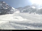
This past March, Mt. Hood, Oregon, took the brunt of that. A parade of storms dumped over 11 inches of precipitation on the mountain in less than a week. The precipitation began as snow but turned to rain toward the end of the cycle, adding a heavy load atop a widespread crust layer that had been buried since March 8. The added weight was enough to trigger a massive, hard-slab avalanche that tore down the mountain.
At approximately 3:30 a.m. on March 14, the slab released naturally on the east-facing Wy’East Face at around 9,800 feet. It was roughly 2,000 feet wide before channeling into Clark Canyon, dropping 4,500 vertical feet, and finally stopping at 5,300 feet. The U.S. Geological Survey’s seismic network captured the event, recording a signal that lasted 10 minutes, according to a NWAC observation, or 15 minutes according to the social post. The avalanche was classified as a D4 on the destructive scale and an R4 on the relative size scale.
Related: [PHOTO TOUR] Aftermath of Massive Mount Shasta, CA, President’s Day Avalanche
Mt. Hood Meadows Pro Patrol first spotted the crown on the morning of March 14. Shortly after, NWAC forecaster Joe Dellaporta submitted an official avalanche occurrence report on March 17, followed by a detailed field observation on March 22, once the high-pressure system broke through, allowing for a closer look at the damage.
While this was one of the larger events during the heavy storms in March, there were multiple other large avalanches throughout the Mt. Hood area, particularly around the canyons and on the north side of the mountain.
Related: White Wilderness Halts Operations After Deadly Avalanche That Killed Swiss Father & 2 Sons Near Terrace, BC
If you were planning to head out into the backcountry this spring, please pay attention to the latest conditions and always be prepared by having the proper equipment, knowledge, and a buddy. This recent avalanche highlights the increased danger posed by new snow, wind-loaded slopes, and warming temperatures, as unexpected spring storm cycles will continue to bring unpredictable conditions.
Mt. Hood Avalanche Photos
The post [PHOTOS] Scientists Used Seismic Data to Uncover the True Scale of This Massive Mt. Hood Avalanche appeared first on SnowBrains.
Ссылка на источник: https://snowbrains.com/photos-scientists-used-seismic-data-to-uncover-the-true-scale-of-this-massive-mt-hood-avalanche/
- 2026-06-25 How a German Tech Firm Finally Brought GPS-Style Navigation to the Avalanche Beacon
- 2026-06-25 Tragedy in the Karakoram: Legendary French Steep Skier Guillaume Pierrel Dies in Avalanche on K6
- 2026-05-23 Avalanche Gear Summer Storage: What Most Backcountry Skiers Get Wrong
- 2026-05-18 Utah Avalanche Center Legend Craig Gordon Retires After 27 Years
- 2026-05-13 Teton County, WY, to Hold Panel on Avalanches and Trauma
- 2026-05-12 Those Window-Rattling Booms on Powder Days? The Howitzers Behind Them Are Nearly Gone
Webcams
News
Snow videos

Chacha Land